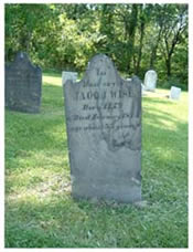
Mary consulted old lists compiled by such groups as the DAR, State Highway Patrol, Soldiers' Burials and a WPA listing as well as topographical maps. She also used Mrs. Anna Zimmerman's notes. Anna was well-known throughout the county for her genealogical efforts. Mary also used newspaper obits and spoke with residents, farmers, hunters who knew the land, as well as funeral home directors. One local funeral home director, Bud Stevers, was very valuable with his advice and help. The cemeteries and their directions are a result of this work. To search for individual names click on Index in the left hand column.
Cemetery
Records
(introduction)
Cemetery
Locations
Page 1
Addison-Reynolds: Located in section 15 on Addison-Bulaville Road opposite the Addison Freewill Baptist Church. Number of tombstones: 300+
Amos Cemetery: Located in section 11 west of Gravel Hill Road on Coal Hill. It’s on top of a ridge that’s been strip mined around. Number of tombstones: 2.
Baker Cemetery: Located in section 17 south east off of Roush Road about ¼ of a mile on strip mine road. Number of tombstones: 5.
Berry I Cemetery: Located in section 17 west of State Route 7 across the railroad tracks. This cemetery was destroyed years ago and markers are flat on the ground in the brush. Number of surviving tombstones: 2.
Berry II Cemetery: Located in section 20 on George’s Creek Road at Lane farm . Two reported burials. No tombstones.
Bethel Cemetery: Located in section 32 at the intersection of Kerr-Bethel and Bulaville –Porter Roads. Number of tombstones: 200+.
Bing I Cemetery: Located at intersection section 22 and 23 on a knoll about 100 yards from the southwest side of Bulaville-Addison road about 1.8 miles from State Route 7 Number of tombstones: 14.
Bing II Cemetery: Located in section 12 about 500 feet south of Little Kyger Road near the intersection of Little Kyger and Gravel Hill Roads, directly south of Kyger Creek High School. Number of tombstones: 40+
Campaign Cemetery: Located in Section 36 at Campaign Church on Campaign-Popular Ridge Road. Number of tombstones: 200+.
Coalman Cemetery: Located in section 34 on east side of Kemper Hollow Road (property of Ural Humphrey) Number of tombstones 9.
Daniel Cemetery: Located in section 29 on south side of Bulaville-Addison Road, wooded plot south of Campaign Creek, near the intersection of Reese Hollow Road. Number of tombstones: 10 + unmarked.
Fulton Cemetery: Located in section 27 on west side of Bunce Road about 1 ¼ miles from Bulaville Village. Number of tombstones: 38 + unmarked.
George Cemetery: Located in section 16 on top of a ridge near Ohio River north of Addison. Number of tombstones: 3.
Guthrie Cemetery: Located in section 8 about 2 miles north of Kanauga and west of State Route 7. Number of tombstones: 10.
Hern Cemetery: Located in section 14 about ½ of a mile west of State Route 7. No surviving tombstones, 2 reported burials.
Johnson Cemetery: Located in section 21 about ½ of a mile west of Polecat Road. Number of tombstones: 3 + unmarked.
Kincaide Cemetery: Located in section 15 at the end of Polecat Road. Number of tombstones: 1.
Leonard Cemetery: Located in section 16 on eastern side of Addison-Bulaville Road about 1 ½ miles from Addison Village. Number of tombstones: 11.
Louks Cemetery: Located in section 16 on top of first hill north of the Tara Apartments. Number of tombstones: 8.
Maddy Cemetery: Located in section 14 north of Georges Creek Road and northwest of the substation. Number of tombstones: 177 +.
McKown Cemetery: Located in section 15 about ¼ of a mile east of Polecat Road near a roadway leading to an oil well. Cedar tree marks cemetery. Number of tombstones: 4.
Rees Family Cemetery: Located in section 8 in a pasture adjacent to the Guthrie Cemetery west of State Route 7 just north of Kanauga. Number of burials reported: 4.
Rife Cemetery: Located in section 29 about ½ of a mile northwest of Village of Bulaville. Number of tombstones: 350+.
Rothgeb Cemetery: Located in section 11 west of State Route 7 and about 1 mile south of Kyger Creek Power Plant. Number of tombstones: 11.
Shaver Cemetery: Located in section 29 east of Blazer Road ¼ of a mile on a wooded ridge by a long needle pine tree. Cemetery has been demolished. Surviving tombstones:1 and one footstone.
Swisher Cemetery: Located in section 12 south of Roush Road near intersection of Roush and Gravel Hill Roads. Number of tombstones: 6 + unmarked.
Trickler/Trackler Family Cemetery: Located in section 11 west of Gravel Hill Road, on Coal Hill. Cemetery is on top of hill and has been strip mined around it. Number of tombstones: 5.
Unknown Cemetery: Located in section 32 in the lower part of northwest quarter is the grave of a colored baby, name unknown. At the time of the burial property was owned by Samuel Johnson. No tombstone.
Unknown Cemetery: Located in section 34, old lists mention “unknown” in this section. Nothing further found on this cemetery and it maybe same as Coalman Cemetery.
Vance Cemetery: Located in section 29. This cemetery was moved from Blazer Road to Rife Cemetery. Reference: Floyd Blazer.
Viars Cemetery: Located in section 14 about ¼ of a mile from Addison Bulaville Road. Cemetery is on property of Floyd Leonard on second hill east of Leonard’s house. No tombstones except fieldstones but 5 graves reported.
Top of Page
Boice Cemetery: Located in section 23 on Jesse Creek on a high hill south of Clair Athey’s house (surrounded by concrete wall). Number of tombstones: 2.
Coughenour Cemetery: Located in section 34 on the north side of State Route 554 and Africa Road. Number of tombstones: 1.
Darst Cemetery: Not located. Several source list cemetery and indicated that the grave of Nathaiel Darst was moved from there possibly to Poplar Ridge.
Gardner Cemetery: Located in section 3, in the western part of the section, about a mile from Schuler Store. Walk, following old township road (across from the store) to end of road. Straight up over rocky terrain to cemetery marked by a cedar. Number of tombstones: 2.
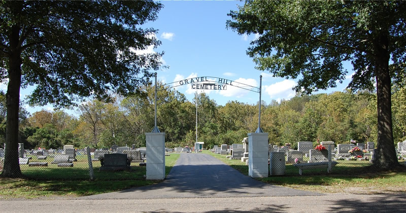
Gravel Hill Cemetery: Located in section 7 on the west side of Gravel Hill Road at the intersection of Turkey Run Road. Number of tombstones: 3250+.
Grover Cemetery: Located in section 17 about 1/ mile north of Jesse Creek Road, Turn at Malinda Bradbury property and look for large cedar. Number of tombstones: 2 +1 extra footstone.
Halfhill Cemetery: Located in section 34 on the east side of Ward Road about 1 mile north of State Route 554. Number of tombstones: 6 + unmarked graves.
Kyger Cemetery: Located in section 16. Turn north in Kyger Village from Route 554 onto Cemetery Road go about ½ mile and cemetery is on the east side of the road on a ridge. Number of tombstones: 175 +.
Lemley Cemetery: Located in section 26on Poplar Ridge Road. Number of tombstones: 32 + unmarked.
Manley Cemetery: Located in section 5 on Paul Searls’ property, in a wooded area about 1 mile north of Story’s Run Road. It’s on top of a ridge practically on Gallia-Meigs line. Number of tombstones: Only 1 found?
McCarty Cemetery: Located in section 7 on Turkey Run Road in sight of Gravel Hill Cemetery. Number of tombstones: 46 + unmarked.
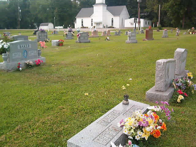
Moore Cemetery: Located in section 19 about 200 feet east of intersection of Moore-Jerico Road and a strip mine road. Number of tombstones: 5.
Paulins Hill Cemetery: Located in section 17. Turn off Route 554 onto Story’s Run Road and go north ½ mile to intersection of Story’s Run, Jesse Creek and Paulins Hill Rd. Go straight ahead ¼ mile and cemetery is west of road. Number of tombstones: 1 + 3 field stones.
Poplar Ridge Cemetery: Located in section 33 between Poplar Ridge and Wheaton Road. Number of tombstones: 450+.
Rife Cemetery: Located in section 9 west of Route 554, near Old Kyger Church, on property of M.P. Darnell. Number of tombstones: 21 + unmarked.
Roush Cemetery: Located in section 8 opposite intersection of Route 554 and Roush Lane. Number of tombstones: 59 + unmarked and unreadable.
Roush Cemetery: Located in section 10 about ½of a mile north of Route 554 on property owned by Joe Willis. Number of tombstones: 1 + several unmarked.
Rothgeb Cemetery: Located in section 28 on the north side of State Route 554 (near intersection of Africa Road and Route 554) Number of tombstones 4+ unmarked.
Russell Cemetery: Located in section 7 in one of newer section of Gravel Hill Cemetery. This cemetery was moved from Van Zant Road because of a coal belt line from Gavin Electric Plant. All new monuments were provided. Number of tombstones: 13.
Scott-Roush Cemetery: Located in section 7 in rear of newer section of Gravel Hill. These cemeteries were moved from Stingy Creek Road. Three graves are from John Roush place and the rest from the Scott Cemetery. Number of tombstones: 21 + 16 markers, marked as Unknown.
Shuler Cemetery: Located in section 25 about 1 ½ miles east from Poplar Ridge Road on a strip mine road (in danger of being lost as early as 1975). Number of tombstones: 25 + unmarked.
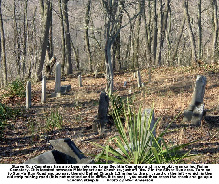
Story’s Run Cemetery: Located in section 4 on the south side of Story’s Run Road about ½ mile from Gallia-Meigs line. (Maybe lost because of strip mining) Number of tombstones: 33 + unmarked.
Thomas Family Cemetery: Located in section 20 on east side of Little Kyger Road in a wooded area. Number of tombstones: 7.
Van Zant Cemetery: Located in section 35. Take Rt. 554 from Cheshire past the village of Kyger. Turn right onto Van Zant road. There is a sign there for the AEP wetlands. Go through the intersection of Van Zant and Ward Roads. The road for the cemetery turns off to the right, up a steep hill approx. 30 ft. from the intersection. There is no sign for the cemetery at the road. Number of tombstones: 86 + unmarked.
White Oak Cemetery: Located in section 31 behind White Oak Church on Nibert Road. Number of tombstones: 6.
Top of Page
Beck Cemetery: Located in section 1 on south side of Texas Run - Providence Road at junction of Providence School Road. Number of tombstones: 1
Berridge Cemetery: Located in section 5 on the top of hill on the west of junction of Northup-Yellowtown Road and Route 218. Number of tombstones: 4
Brown Cemetery: Located in the upper part of section31 on the southwest side of Route 7 just south of junction of Old Route 7 on a point overlooking the Ohio River. Also known as Plymale Cemetery. Number of tombstones: 12
Brucker Cemetery: Located in section 25 about 1,500 feet west of Route 7. Number of tombstones: 8
Clark Cemetery: Located in section 21 on west side of Route 7, about 30 feet south of old concrete bridge. Number of tombstones: 5
Clay Chapel Cemetery: Located in section 21 on State Route 7 at junction of Clay Chapel Road. Number of tombstones: 463
Coffman Cemetery: Located in section 30 one mile south of Clipper Mills and 1,500 feet west of Route 7 on top of cliff in woods. Number of tombstones: 9
Cottrell Cemetery: Located in section 34 on the north side of Clay Chapel - Yellowtown Road on hill between road and Raccoon Creek. Number of tombstones: 75
Earwood Cemetery: Located in section 4 on east side of Frieldly Ridge Road. Number of tombstones: 13
Flack Cemetery: Located in section 21 west of Route 7. Number of tombstones: 1
Gibson Cemetery: Located in section 26. Two burial sites. No stones.
Gooldin Cemetery: Located in section 26 on the south side of Raccoon Creek. Number of tombstones: 2
Harrington Cemetery: Located in section 5 on State Route 218, two miles from junction of State Route 7. Number of tombstones: 14
Hazlett Cemetery: Located in NE ¼ of section 31. Number of tombstones: 12
Lasley Cemetery: Located in section 34 in the woods on a point about 200 yards from Raccoon Creek. Number of tombstones: 2
Littleton Cemetery: Located in section 4 on Route 218 just past Williams Hollow Road. Number of tombstones: 7
Long Family Cemetery: Located in section 1 at the end of Wickline Road, about ½ mile west of Davis Road. Number of tombstones: 5
McLellon Cemetery: Located in section 20 on Teens Run Road about ¼ mile from Route 7 on north side of road. Number of tombstones: 11
Middleswarth Cemetery: Located in section 19 along the bank of the lake. Number of tombstones: 2
Providence Cemetery: Located in section 1 in back of Providence Church on Providence Road. Number of tombstones: 515
St. Nick Cemetery: Located in section 4 on Friendly Ridge Road. Number of tombstones: 257
Canaday Cemetery: Located in section 24. Number of graves unknown. No surviving tombstones.
Mound Hill Cemetery: Located in section 33 overlooking Gallipolis and the Ohio River. Number of tombstones: 4804
Pine Street Cemetery: Located on the east side of Pine Street in Gallipolis along State Route 160. Number of tombstones: 3276
Pine Street Cemetery Colored: Located on west side of Pine Street in Gallipolis along State Route 160. Number of tombstones: 274
Plymale Cemetery: Located in section 31 on west side of Rt. 218 about ¼ mile south of jct. with Rt/ 7. Number of tombstones: 14
Potters Field: Located in section 23. No markers located.
Single Grave: Located in section 34 on Route 588. Number of tombstones: 1
St. Peter's Episcopal Columbarium: Located in St. Peter's Episcopal Church in Gallipolis. Number of graves: 2
Allison Cemetery: Location unknown. 2 burials
Asbury Cemetery: Location in section 25. There are burials here but no tombstones currently present.
Blazer Cemetery: Located in section 15 on the south side of State Route 141. Burials here but no tombstones currently present.
Campbell Cemetery: Located in section 5 on the east side of Bob McCormick Road. Number of
tombstones: 3
Catholic Cemetery: Located in section 27 on the north side of State Route 141 about one-half mile southeast of the junction with State Route 775. Number of tombstones: 28
Centenary Cemetery: Located in section 15 on the north side of State Route 141 in the Village of Centenary. Number of tombstones: 811
Coverston Cemetery: Located in section 30 on Wilson Bostic Road just south of Rodney. Number of Tombstones: 6
Detalente Cemetery: Located in section 24 on the south side of U. S. 35 on a hill west of Rodney. Number of tombstones: 6
Fairfield Cemetery: Located in section 18 just off State Route 588 on the Fairfield-Centenery Road. Number of tombstones: 44
Hulbert Cemetery: Located in section 34 on the north side of State Route 141. Number of tombstones: 187
King Cemetery: Located in section 8 south of King Road. Number of burials 15
Lowvy Family Plot: Located in section 34 on the north side of State Route 141. Number of tombstones: 3
Mina Chapel Cemetery: Located in section 2 on both sides of Neighborhood Road at Mina Chapel. Number of tombstones: 275
Mitchell Road Unknown Cemetery: Located near section line of 17 and 18 on north side of State Route 588 near junction with Mitchell Road. No markers but sunken gravesites present.
Mosby Cemetery: Located in section 10 east of Crouse-Back Road. Number of tombstones: 2
Mt. Zion Cemetery: Located in section 6 on Mt. Zion Road. Number of tombstones: 502
Ohio Valley Memory Gardens Cemetery: Located in section 3 at the intersection of Le Grande Boulevard and Neighborhood Road. Number of tombstones: 531
Questel Cemetery: Located in section 20 less than 1/4 mile off Blessing Road as you come from Northup-Patriot Road. Number of tombstones: 9 plus possibly 12-14 unmarked graves.
Rose/Northup Cemetery: Located in section 13. From Llincoln Pike take Northup-Yellowtown Road about 3/4 mile to Smeltzer Rose's Land. Some locals call it Rose Cemetery and to others it is Northup. Number of tombstones: 72
Willey Cemetery: Location unknown, but mentioned on old cemetery list.
Greenfield Township
Briar Cemetery: Located in section 20 about 50 feet north of Pokepatch Road and about 1000 feet southwest of intersection of Thomas EvansRoad . Number of tombstones: None
Chavis-Shaffer Cemetery: Located in section 13 on a wooded point ¼ mile directly south of intersection of Simms and Lew Davis Roads (at least 15 reported burials of Chavis-Hutchinson families.) Number of tombstones: fieldstones only
Dummy Cemetery: Located in section 12 northeast of Symmes Creek Road and south of Gallia Centerpoint Road, about 200 yards from their junction (reported at least 6 burials, one of which was a muted named Bill from which the name is derived). Number of tombstones: None
B.F.Evans Cemetery: Located in section 13 in the southeast part of the section about 1,500 feet south of Symmes Creek Road on property owned by Steven’s (1978). Number tombstones: 2 (over grown so possibly others).
Ewing Cemetery: (colored) Located in section 19 west of Keels Road and north of Tom Coker Road, near center of section. Reported by Eleanor who believes “Maggie” Cradolph is among those buried here. Number of tombstones: None
Farney-Oliver Cemetery: Located in section 29 about 2/10 of a mile north of Hoadley Road. Now it’s a part of Wayne National Forest. Last burial was about 1902. Tombstones: None
Foster Cemetery: Located in section 14 about ½ of a mile northeast of Pumpkin Town Lake. Tombstones: None
Gallia Baptist-Ridge Cemetery: Located in section 22 on the east side of Dry Ridge Road. Church sign says Gallia Baptist Est. 1887. Number of tombstones: 400+
Gallia Methodist Cemetery: Located in section 16 on the north side of Frank Shaffer Road. Number of tombstones: 150 +
Hammond Cemetery: Located in section 12 & 13 near the Perry Township line. Fenced on two sides appear to be about 20 square feet. Number of tombstones: None
Lee 1 Cemetery: Located in section 11 in a wooded area off south side of Gallia-Centerpoint Road on land owned by Floyd Simmons (1977). Number of tombstones: 1
LeeII Cemetery: Located in section 33 on the south west side of Betz Road about ½ out road and ¼ mile into woods. (near the Lawrence Co. line) Number of tombstones: 2 + at least 11 unmarked.
Oliver-Grump Cemetery: Located in section 7 northwest of Potter Road on property owned by Clayton Fogle. (1979). All of the stones are down on the ground. Number of tombstones: 5
Owney Cemetery: Located in section 14 about 600 feet northeast of lake on Call-Fultz Road. Richard Owney’s grave marked by Lilac bush b. 1782 d. 1852 information from great-grandson Richard Owney. Number of tombstones: None
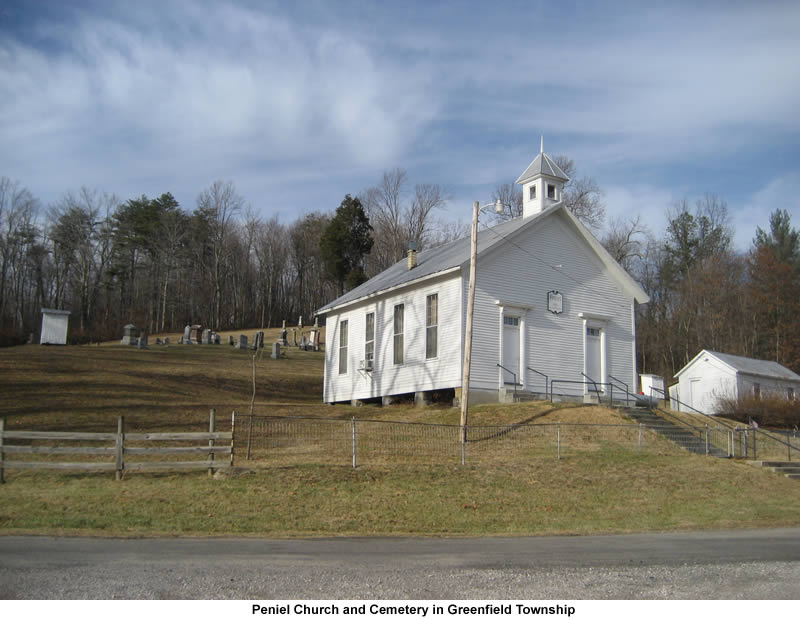
Peniel Cemetery: Located in section 21 on the C.H. & D. Road directly north of junction with Camp Creek Road. Sign on church says Peniel Community Church. Number of tombstones: 150 +
Rose-Wood Cemetery: Located in section 30 about 300 feet up a bank on the east side of Dirty Face Creek. Number of tombstones: None
Shaffer Cemetery: Located in section 8 on the north side of Frank Shaffer Road near the Thomas Evans and Kokeen Roads. Number of tombstones: 17
Stafford Cemetery: Located in section 10 in the center of northwest quarter on a ridge about 3/10 of a mile north-northeast of Route 233. It is now part of the Wayne National Park. (Supposed to be about 30 graves, but these were reported to have been used to construct two spring troughs on a nearby farm) Number of tombstones: 1 broken stone survives (John Shelton d.1---)
Stewart Cemetery: Located in section 20 in the southwest quarter. Three cedars on a knob mark location. (Now on government owned property) Number of tombstones: 1 footstone (E.C.) and at least 4 field stones.
Thomas Cemetery: Located in section 20 about 300 feet north of the Polk Patch Road near the intersection with the Jack Philips Road. Number of Tombstones: None
Unknown Cemetery: Located in section 27 on the Jesse Crews Road on the Haney property. The stones have been removed and used in various locations on the property.
Unknown Cemetery: Located in section 22 about ¾ of a mile northeast of C.H. & D Road. Number of tombstones: possible sandstone markers?
Unknown Cemetery: Possibly Davis, located in section 13 on Davis Ridge very near the Perry Township line. Number of tombstones: None
Wagner Cemetery: Located in section 23 on top a hill with three cedars on the north side of Morgan Sisters Road. Number of tombstones: 23
Woodruff Cemetery: Located in section 32 about 100 feet north of a government survey marker at the intersection of sections 32 and 33, in the southwest corner about ¼ of a mile south of Dry Ridge Road. Number of tombstones: 2 fieldstones.
Woods Cemetery: Located in section 21 on the east side of the C.H. & D. Road in the north east quarter. Number of Tombstones: 26 and at least 18 unmarked.
Guyan Township
Bay Cemetery: Located in corner of sections 7, 8, 13 and 14 nor of State Rou te 7. Number of tombstones: 3
Bethlehem Cemetery: Located in section 22 on the north side of Rocky Fork Road behind Bethlehem Church. Number of tombstones: 55
Blankenship Cemetery: Located in section 36. Although there are known to be graves here, there are presently no markers.
Campbell Cemetery: Located in section 10 on Hannan Trace Road just out from Route 218. Number of tombstones: 40
Chapman Cemetery: Located in section 26 on Williams Creek Road. Number of tombstones: About 20 (several graves with unidentified fieldstones)
Crown City Cemetery: Located in section 13 on the southeast side of Route 7 in the village of Crown City. Number of tombstones: 578
Davis Cemetery: Located in section 32 on Williams Creek Road. Number of tombstones: 1
Fellure Cemetery: Located in section 35 on Bidwells Road off Saundersville Road. Number of tombstones: 46
Foster Cemetery: Located in section 14 north-east of Route 553, one-fourth of a mile from the junction of Route 218 and Route 553. Number of tombstones: 16
Fulks Family Cemetery: Located in section 25 of Guyan Township about one-half mile north of the Lawrence County line near Scottown. It is across Guyan Creek from St. Rt. 218 which runs adjacent to it. In 2011 it is just north of the Lafe Barry property which is on the same side of the creek as the cemetery.
Number of tombstones: 5
Garlic Cemetery: Located section 21 one-half mile south of Fulks Road on the north side of State Route 218. Number of tombstones: 4
James M. Garlic Cemetery: Located in section 16 one-fourth of a mile north-east of the junction of Lane's Branch and State Route 218. Number of tombstones: 7
Good Hope Cemetery: Located in section 20 at Good Hope Baptist Church. Number of tombstones: 446 plus 17 unmarked graves.
Guyan Townhouse Johnson Cemetery: Located in section 16 about one-fourth mile of Route 218 on the west side of Guyan Townhouse Road. Number of tombstones: 42 with possibility of 20-30 more unmarked graves.
Halley-Haskins Cemetery: Located in section 15 about 50 yards north of Route 218. Number of tombstones: 42 plus about 20 more unmarked graves.
Harbour Cemetery: Located in section 12 on the south side of Cox Mercerville Road three-fourths of a mile from the junction with Route 218. Number of tombstones: 3
Jeffers Cemetery: Located in section 31 about 100 yards west of township road no. 18 where it enters Lawrence County. Number of tombstones: 5 plus several unmarked graves.
Johnson Cemetery: Located in section 9 on the north side of Soward's Ridge Road one-fourth mile northeast of Double Creek Road. Number of tombstones: 2
Mercerville Cemetery: Located in section 12 in the village of Mercerville. Number of tombstones: 474
Mt. Moriah Cemetery: Located in section 34, 150 feet southeast of the junction of Garland and George's Creed Roads. Number of tombstones: 9
Notter Cemetery: Located in section 36 on the north side of Saundersville Road. Number of tombstones: 3
Paregon Cemetery: Located in section 30 north of State Route 790. There are graves here but no markers.
Ridgelawn-Mercerville Cemetery: Located in section 15 on the north side of Bladen-Mercerville Road about one-fourth mile from the junction with Route 218. Number of tombstones: 507
Robinson Cemetery: Located in section 12 one-half mile northeast of the junction of Cox-Mercerville Road and Route 218. Number of tombstones: 1
Sheets Cemetery No. 1: Located in section 30 near the line of section 36, Cemetery Road, just at the junction of Route 790 and Saundersville Re. Number of tombstones: 63 plus an estimated 12 unmarked graves.
Sheets Cemetery No. 2: Located in section 33 one-fourth mile north of the junction of Good Hope and Garland Creek Road. 26
Siloam Cemetery: Located in section 29 about one-fourth mile north of the site of Siloam Church and one-half mile north of Rocky Fork Road. Number of tombstones: 16 plus several unmarked graves.
Simms Cemetery: Located on the line between sections 13 and 14, one-fourth mile south of the junction of Williams & Law Southers Roads. Number of Tombstones: 14 plus a dozen or so unmarked graves.
Stewart Cemetery: Located in section 28 between Forky Fork Road and Town House Road. Number of tombstones: 91
Stover, Jubal Cemetery: Located in section 28 near the line of section 22. South of Rocky Fork Road and about one-fourth mile on a high point east of Stewart Chapel Road and north of Townhouse Road. Number of tombstones: 0 but has the appearance of having about eleven graves.
Swindler Cemetery: Located in section 11 on the east side of Route 218, south of the junction of Rocky Fork Road and Route 218. Number of tombstones: 34
Unknown Cemetery: Located in section 36 off Route 790 on the east side of Saundersville Road. There is now no trace of a cemetery here, but it is thought there are 5-6 graves here.
Harrison Township
Bane Cemetery: Located in section 17. No marked graves.
Boster Cemetery: Located in section 22 about one-half mile from Macedonia Church northwest of Clay Lick Road. Number of tombstones: 1
Calhoun Cemetery: Located near the line of sections 27 and 21 near aone the east side of where Hamilton Road ran. Number of tombstones: 4, but many unmarked graves.
DeWitt-Serrier Cemetery: Located in section 21 on the north side of Ingalls Road. No tombstones, but there are several graves here.
Dickey Chapel-Mt. Pleasant Cemetery: Located in section 26 on the south side of Hannan Trace Road at the junction of Fairview Road. Number of tombstones: 148
Fillinger Cemetery: Located in section 31 on the west side of Martt Road. Number of tombstones: 3 but about three more graves marked with stones.
Harrison-Crinner Cemetery: Located in section 12 on the south side of Raccoon Creek. All markers destroyed.
Hopewell Cemetery (Lewis): Located in section 31 about three-fourths mile west of junction of Martt and Fairview Roads on the north side of the road. Number of tombstones: 26
Houck Cemetery: Located in section 32 one and one-half miles east of junction of Houck and Lincoln Pike roads. Number of tombstones: 131 plus 7 unmarked fieldstones.
Landthorn Cemetery: Located in section 22 on the top of a hill on the east side of Clay Lick Road. Number of tombstones: 5
Leaper Cemetery (Dickey): Located in section 7, one-fourth mile south of junctin of Teens Run and State Route 218 on the south side of the road. Number of tombstones: 6
Lewis Cemetery: Located in section 16. In the woods on top of a hill on the right of Lewis Road about one-half fmile from State Route 218. Number of tombstones: 12 and possibly some more unmarked graves.
Lincoln Pike Chapel Cemetery: Located in section 33 near the intersection of Lincoln Pike and Boggs-Lincoln roads. Number of tombstones: 10
Loucks Cemetery: Located in section 10 just off State Route 218 about 3 miles out from State Route 7. This cemetery was restored in the year 2000. Number of tombstones: 14
Macedonia Cemetery: Located in section 16 on the north side of Clay Lick Road at the site of the Macedonia Church. Number of tombstones: 202 and 2 unmarked fieldstones
Martt Cemetery: Located in section 31 about the middle of the southern side of the section right on the Guyan Township line. Number of tombstones: 17
McCall Cemetery: Located in section 29 on the west side of Lincoln Pike about 1 mile south of junction of Smoky Row Road. Number of tombstones: 31 plus many unmarked graves.
Mt. Carmel Cemetery: Located in section 21 on the north side of Little Bull Skin Road at the site of the church which is now abandoned. Number of tombstones: 60
Perkins Cemetery: Located in section 9 on the north side of Perkins Road. Number of tombstones: 3
Smith Cemetery: Located in section 8 on the east side of State Route 218 just south of Brumfield Road. Number of tombstones: 19
Trotter Cemetery: Located in section 9 straight back of Bailey Chapel on State Route 218. Number of tombstones: 3
Walter Cemetery: Located in section 28 on the west side of Lincoln Pike. Number of tombstones: 11
Waugh Cemetery: Located in section 8 on the east side of State Route 218 north of junction with Brumfield Road. Number of tombstones: 51
White Cemetery: Located in section 35 on White Cemetery Road. Number of tombstones: 59